Border Ranges Day Run – March 21
Editor’s Note: The author is unknown, can anyone tell me who it is so I can add their credit?
Social Run 7.3.21: Is there a worse way to start a LCQ social run? The coffee machine was broken at our starting location, BP Jimboomba! A couple of quick-thinkers made an emergency dash to the nearest coffee vendor and soon enough the natural balance of affairs was restored and the troupe was ready for departure.
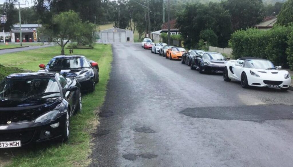
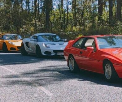
The group comprised about a dozen cars and around two dozen Lotus Club members and friends. Lots of Elises, an Evora, an Exige, two black Europa S cars (one looked concourse ready; the other, with GT stripes, I am told, was the quicker car) plus a couple of other cars from lesser marques (Porsche and Toyota). The folks were mostly from Brisbane, plus others from the Gold Coast and nearby Kooralbyn. Several newer members joined the run, which was welcome.
Carol did a great job of getting us all organised and emailing us a list of directions. Steve monitored attendance and texted group members a Google map with route directions – teenagers would have been proud of us Boomers using new tech. Hard copy instructions were also available for those so inclined. Luckily, Ken, as a significant ex-landholder in the district, knew the local roads intimately. He was able to provide the group with a heads-up on likely police speed-trap locations and hazardous sections of the Lions Road. Very important information. Ken led the delegation, stopping at intervals to gather up the group and provide advice on the route. He also slowed down the convoy at particularly hazardous locations.
Our route was south on Mt Lindesay Highway running through on the floodplain adjacent the Logan River, framed by mountain ranges. Mount Tamborine to the east and Flinders Peak Conservation Park to the west provided a refreshing vista in the distance.
Thankfully, there was a bypass around Beaudesert. As an aside note, when I got home, I checked the satirical Facebook group S#it Towns of Australia (check it out). Neither Beaudesert nor Jimboomba got a mention, although I would have thought both deserving of one.
We turned off the Mt Lindesay Highway onto Innisplain Road which became Lions Road and then Grady’s Creek Road. We all remember the terrible drought conditions of last year where the countryside looked like burnt toast. After the recent good rains, the bush was vibrant green. Grasses a meter high. Fire-damaged tree bursting with new growth. Brilliant.
It has been many years since I did the Lions Road run. I remember most clearly the terrible road. So many pot holes that there was virtually none of the original bitumen to be seen. And the bridges: wooden, shaky and somewhat disconcerting.
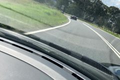
The road is now noticeably improved: some newer surfacing and some concrete bridges. However, it’s still tricky; one lane in parts, blind corners, potential for wandering livestock and animals, on-coming traffic appearing around tight corners, the necessity to space out the cars so as to avoid stone chips from the car ahead driving with two wheels on the dirt, plus some still treacherous bridge approaches and cattle grates which could easily rip off a splitter – or worse. Luckily we had a guide, Ken. Even with that, I still lightly grazed my splitter getting onto a bridge.
Yet, the road was great fun – if driven with caution. You travel alongside Running Creek, West of Mount Chinghee National Park. The road winds back and forth across the river, past small farms and houses that surely flood when the water is up. The road turns east at the southern boundary of the national park for a couple of kilometres before bearing south, through the border ranges.
As soon as you enter NSW, the roads really do get better. Probably something to do with them having twice the population of Queensland and half the real estate and road network. In all fairness, NSW probably has some of the best roads in Australia. We will get to try more of them on the Grand Tour later in the year.
The drive through the border ranges is a treat. Tight and twisty roads up and down through the dry sclerophyll range forest, with patches of rain forest. After a good drive to the southern end of The Risk we joined Summerland Way and headed west for half an hour on wider sweeping roads in the valley between mountains – beautiful countryside. Eventually the road joined back up with the Mount Lindsey Road, just north of Wodenbong, our luncheon location.
The Wodenbong pub was good. Well presented, spacious and with good atmosphere. The lunch menu was pretty much standard country pub fare: burgers, steak sandwiches, fish, calamari or chops. Chips was the main vegetable – salad was a special order. The pub also made up some falafels for members of our group; which was good of them.
We all sat at a long table, chatting freely and enthusiastically about the drive with people we had only met that day. There was also a general consensus at our end of the table that having Steve permanently appointed to the role of Club President seemed like a good idea to us. A couple of us newer members signed up for the distribution list for the Early Morning Run (EMR) group that goes up to Mt Glorious on some Sundays for breakfast. If you are not on the list, contact Steve for details.
When ready, people headed north, back to Rathdowney, Beaudesert and beyond. Again, we crossed up and over the Border Ranges through some magnificent forest and stunning stands of ghost gums. Over the range, gentle sweepers meandered through lovely open country. Why is that some other non LCQ drivers are so light footed on the bends and yet so lead footed on the straights? Luckily, if you are driving a Lotus, overtaking them is not a problem.
All up, it took us about two hours to get Brisbane city. The worst bit of road on the trip? The Jindalee bridge. Many thanks to the organisers and participants.
If you are a club member and have not been on one of these social drives, you should give it a try. Suitable for young and old; experienced drivers or beginners. Hopefully we will see you at one of the outings.
